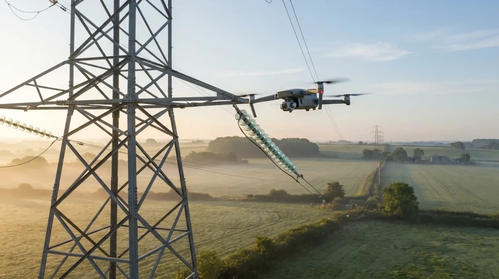
Drone power line and pipeline inspection replaces much of the foot patrol and helicopter work on routine checks. A drone flies the corridor with cameras, a thermal sensor or LiDAR, and brings back images and point clouds of every tower, span or pipeline section. The flight is rarely the hard part. The hard part is turning thousands of images into a short list of defects, each tied to a known asset, that a maintenance crew can find and fix.
What do drones inspect on power lines and pipelines?
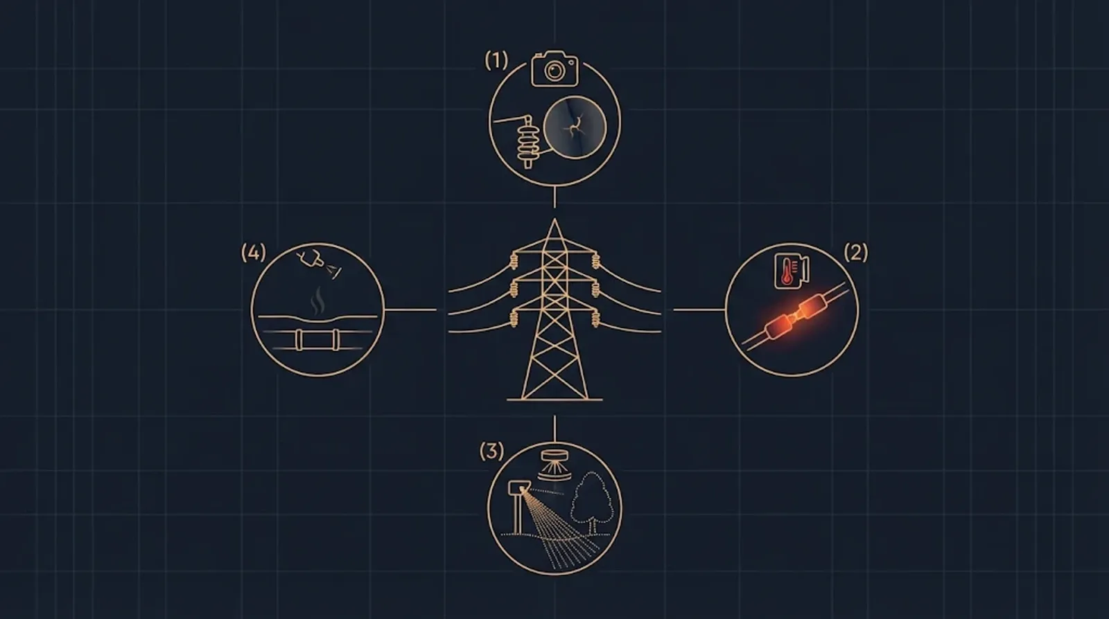
On overhead lines, the usual targets are:
- Conductors and fittings: broken strands, damaged clamps, missing pins and spacers.
- Insulators: cracks, contamination and burn marks.
- Towers and poles: corrosion, missing bolts, damaged foundations and bird nests.
- Vegetation: trees and branches growing toward the conductors, which have to be kept at a safe distance.
On pipelines, the drone looks at the right of way rather than the buried pipe: digging or building work near the line, ground movement, exposed sections and signs of a leak.
Which sensors does each job need?
| Sensor | What it finds | What it produces |
|---|---|---|
| High-resolution camera | Cracked insulators, damaged fittings, corrosion | Thousands of large still images |
| Thermal camera | Joints and connectors that run hot under load | Radiometric images, each pixel a temperature |
| LiDAR | Vegetation clearance, conductor sag, terrain changes | Point clouds of the whole corridor |
| Gas sensor or gas-imaging camera | Methane leaks along a pipeline | Concentration readings or video |
Close inspection of towers is usually done with a multirotor that can hover and frame each fitting. Long corridors suit a fixed-wing or VTOL aircraft that covers distance on one battery. Many programmes use both.
How much data does one inspection flight produce?
More than any radio link can carry in flight. A rough example, our arithmetic: a 45-megapixel camera that saves about 20 MB per image and shoots every two seconds for an hour of flying brings back about 1,800 images, close to 36 GB. A LiDAR survey of the same corridor adds its point cloud on top.
The full-resolution data therefore travels home on the aircraft’s storage. The link carries telemetry, commands and a low-resolution video preview. This shapes the whole data path. Quality problems such as a blurred frame, a missed tower or a thermal image without a temperature scale have to be caught before the crew leaves the site, or the flight has to be repeated.
What does the data path have to handle?
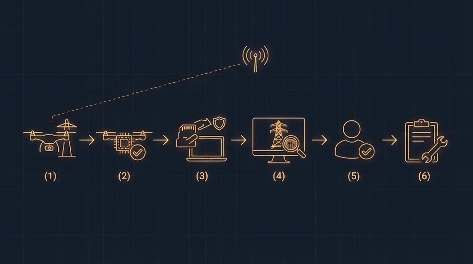
Position, time and angle for every image. Each frame needs the aircraft’s position, the camera’s orientation and an accurate timestamp. Satellite positioning with real-time kinematic (RTK) correction makes the position far more precise than a standard GNSS fix. Without good metadata, a defect in an image cannot be placed on a specific structure.
The asset each image shows. Utilities manage towers, spans and pipeline sections, not coordinates. Linking images to asset identifiers from the operator’s asset register is what lets a finding become a work order. The asset list should be loaded before the flight, not matched afterwards by hand.
Checks on board, before landing. An on-board computer can check image sharpness and coverage during the flight and flag likely defects for a closer look while the aircraft is still on station. It does not replace the full analysis on the ground. It saves the second trip.
Offload with integrity. Copying tens of gigabytes from the aircraft is routine, but files get lost, renamed or copied twice. Checksums and a record of which flight produced which files make the data trustworthy months later, when someone asks how a defect was found.
Analysis with a person in the loop. Photogrammetry builds 3D models, point-cloud software measures clearance, and AI models sort images by likely defect. An engineer confirms each finding, sets its severity and decides whether a crew goes out.
A record the maintenance system understands. The output is not a folder of images. It is a defect record with the asset, its location, the defect type, severity, the evidence images and the date, in a format the operator’s asset management or work order system can import.
Repeatable flights. Flying the same route at the same angles on each cycle lets the next inspection compare against the last one. Slow changes such as corrosion, sag or a tree growing toward the line show up as differences, not as new findings each time.
Which rules apply to beyond-visual-line-of-sight inspection?
Line and pipeline corridors run for many kilometres, so inspection programmes sooner or later need to fly beyond visual line of sight (BVLOS).
- European Union. BVLOS flights fall in the specific category. EASA lists two EU standard scenarios. STS-02 covers BVLOS with airspace observers over a controlled ground area. An operator flying under a standard scenario submits a declaration to the national aviation authority instead of applying for an operational authorisation. Operations outside the standard scenarios need an authorisation, based on a predefined risk assessment (PDRA S-02 covers the same operation as STS-02 without a class-labelled drone) or a full SORA.
- United States. Routine BVLOS flight still runs on Part 107 waivers. The FAA published its proposed Part 108 rule for BVLOS operations on 7 August 2025 and reopened the comment period in early 2026. As of November 2026, no final rule had been published in the Federal Register.
Rules decide more than permission. A BVLOS operation needs reliable links, a defined reaction to a lost link and a way to keep clear of other aircraft. Those are engineering requirements for the aircraft and its software.
How to start a drone inspection pilot
- Pick one corridor with a known history of defects, so the results can be checked against what crews already know.
- Define the defect classes and the record first: what counts as a defect, how severity is graded and which system receives the result.
- Load the asset register into the flight plan so every image is tied to a structure from the start.
- Fly within visual line of sight first, then extend once the data path works end to end.
- Measure the whole chain: time from flight to confirmed defect, share of images that were usable, repeat flights avoided.
Perfsol builds uncrewed systems with day and thermal cameras and LiDAR payload integration, including fixed-wing airframes for long inspection corridors. Our onEDGE companion computer runs computer vision on board, the kind of processing that image checks and early defect flags need before the aircraft lands.
Questions we are asked
Can drones inspect power lines beyond visual line of sight in Europe?
Yes, in the specific category. Standard scenario STS-02 covers BVLOS flights with airspace observers over a controlled ground area and needs only a declaration to the national aviation authority. Other BVLOS flights need an operational authorisation, based on a predefined risk assessment (PDRA) or a full SORA.
Which sensors are used for power line inspection by drone?
High-resolution cameras for insulators, fittings and conductors, thermal cameras for joints and connectors that run hot, and LiDAR for vegetation clearance and conductor sag along the corridor. Pipeline flights add gas sensing and look for ground movement and work near the pipe.
Can AI find defects in inspection images automatically?
It can flag likely defects and sort thousands of images by priority. An engineer should still confirm each finding before it becomes a work order, because a false alarm sends a crew out for nothing.
Sources
- Civil drones: specific category, EASA
- Standard scenario (STS), EASA
- Beyond Visual Line of Sight (BVLOS), 6 August 2025, Federal Aviation Administration
- Normalizing Unmanned Aircraft Systems Beyond Visual Line of Sight Operations (proposed rule), Federal Register
- Normalizing Unmanned Aircraft Systems Beyond Visual Line of Sight Operations; Reopening of Comment Period (10 February 2026), Federal Register
- Engineering connected products for energy environments: every reading needs its asset, unit, timestamp and source, Indeema
- Drone software development for aircraft that have to fly, link and update, Indeema